
The state of Queretaro is one of the many jewels of Mexico, surrounded by a vast nature where rivers, mountains, jungle, history, culture, magical towns and the warmth of the people mix to make your visit unforgettable and today, we will tell you a little about this state and the cities that are part of it. Are you ready? Let’s get started.
Table of Contents
Querétaro State
The State of Queretaro is located in the heart of Mexico, just two hours away from Mexico City and its a treasure chest awaiting to be discovered.
Your name originates of the “Tarasco” and originally of QUERETAPARAZICUYO or YCHAHTZICUYO, that to be abridged remain in Queretaro that it means “Game of Ball“. There are other versions that assure that the name originates of Querenda “Stone large or rock”; or of Querendaro “Place or large stones people or cliffs”.
This State is one of the smallest in extension in Mexico with a population of approximately 1’404,306 inhabitants, since its greatness rests so much in architecture, as its wealth in historical facts, its beautiful spots, its thermal waters and curative, large heights to escalate and also caverns to descend and explore.

Where is Queretaro located?
Located in the south of the central table, Queretaro limits to the north and northwest with the State of San Luis Potosi; to the east with the State of Hidalgo; to the south, with the State of Michoacan and to the southwest, west and northwest with the State of Guanajuato. Queretaro limits to three rivers: the Santa Maria de Acapulco, the Moctezuma and the Lerma.

What is the climate in Querétaro?
The Queretaro climate is a gift for the lovers of the nature. Within territory is changing for the variety of heights on the level of the sea. Thanks to this, the spectacle panoramic that it can be appreciated within the entity is: El Chaparral Espinoso (The Prickly Chaparral), El Matorral Des�rtico (The Desert Scrub), El Sotobosque and El Bosque de Encino y Pino (The Forest of Oak and Pine).
Also, in the upper part of the Queretaro State, it can be enjoyed tropical climate and sub tropical of height, with an environment decorated by mountain chains and large valleys.
Toward the depths, in the subsoil, in the Arroyo municipality, exists the cellar deeper of the world, known as (Mud Basement).
Queretaro Cities
Queretaro is split into 18 municipalities and each one of them has its own tourism resources, that they invite to enjoy a rest depending on their pleasures, climate or landscapes . Below we will talk a little about some of them, so let’s start.
Amealco
Amealco is located 213 km from Mexico City by the federal highways 57D and 120 in the State of Queretaro in Mexico. Amealco is characterized because of its springs.
Among the most interesting attractions you can visit are:
- The Main Square which is surrounded by beautiful colonial arcades
- The Parish built in the XVIII century
- Los Cuisillos a small archaeological zone situated on the corner of San Idelfonso street

Cadereyta
Cadereyta is a interesting colonial town located 217 km to the north of Mexico City by the federal highways 57D and 120 in the State of Queretaro in Mexico.
The climate is mostly dry, and the average temperature is 16° F. During winter, it can go down to 12° F. The altitude is 1,850 meters above sea level. Cadereyta Tourism Attractions:
- Church of San Pedro and San Pablo First built by the Franciscans in 1725 and finished until 1731
Solitude’s temple Neo Classic temple built in the 19th Century. Main accesses adorned with a couple of capitols, the right hand side, there are two beautiful columns with a cupola on top. - San Gaspar and de Refugio Churches famous characteristics of the XIX century are displayed in the facade, although the temple is ornamented with original baroque style.
- Toluquilla Archaeological Site Strategically built on top of the Toluquilla hill and surrounded by cliffs, the site has only one entrance on the north side. Used as a fortress, the place follows the same natural shape of the MESETA. The materials used to built were stone and earth; the combination can be seen on the walls and facades. Among the most representative pieces are the ball game courts, and pyramidal basements.
Quinta Schmoll also known as the “Casa de los Alemanes” (the House of the Germans) where you can admire and purchase a great variety of cetacean.
Hydroelectric Zimapan Complex Enormous dam considered to be one of the most important in the Country. Going across the tunnels underneath the hills and observing the high-pressure water falls are great reason to visit the place. Hydroelectric Zimapan Complex in Cadereyta, Queretaro, Mexico
Colon
Colon was first inhabited by Chichimecas and Otomies indigenous cultures. Their main activities were the obsidian carvings to make arrows, knifes and other tools used for hunting. In 1550, the otomies, tarascos and mexicas helped the Spaniards to conquer the Chichimecas. Lately during the Colonial period, the people developed some agriculture, mine work and commerce.
El Marques
El Marques is located only 5 miles from Queretaro city, it has semidry climate and an average temperature of 61° F.
The Chichimecas who inhabited El Marques, called the land Tlaxco (ball game). By 1850, the Spaniards called the area Hot Water Canyon. In 1941, the former seat of government of the state was converted to a municipality and in 1949 was named El Marques.
Tourist attractions:
- San Pedro Apostle Temple This neoclassic church was built in the 19th century. Beautiful frescos and windows are outstanding.
- La Cañada Grand Temple The construction of this great structure began in 1741, for 130 years, workers put in the foundation, the walls, the buttresses and church houses, there was nobody to take charge of putting in the arches and curved ceilings. Finally, the church was finished in 1873 under the direction of architect Francisco Amaya Avendaño.
- San Antonio Chapel Descending from the Camino Real to the Presa del Diablo or Devil’s Dam, you will find the remains of this ancient chapel.
- Pan de Dulce Obelisk Here sits the highest place in town, where Conin stood to speak when he received the first Spaniard in this region, Hernan Perez de Bocanegra, showing the great extension of his land, inhabitants and natural resources.
- Del Carmen This dam, found in the community of Los Pocitos, has a rock curtain fashioned to look like a single unit.
Ezequiel Montes
Ezequiel Montes was named after an illustrious lawyer, is located 37 miles northwest of Queretaro City on a federal highway. The regional Cuisine among the typical dishes are the lamb cooked with maguey leafs, cactuses, maize dough with pork and enchiladas. Fruits covered with sugar such as pumpkin, apple, apricot and some others are also famous. Since the 16th century, the inhabitants of the area are well known because of the knitting goods made of wool and cambaya. Ponchos, carpets and sarapes are typical.
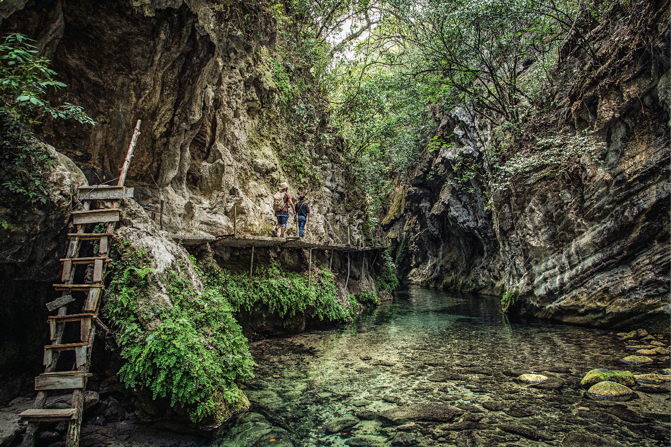
Landa de Matamoros
Landa comes from the Chichimeca word Lan-ha, which means watery a swam ply place. Landa is found in the northern part of the state at 3412 ft. above sea level, in the region where the average temperature is a pleasant 71° F. Leaving Mexico City, take highway 57 (Mexico-Queretaro)
After km. 171 in San Juan del Rio, take highway 120 (San Juan del Rio-Xilitla) Landa 124 Miles from that turnoff. Landa was founded in the 17th century by a tribe of Tarascans from the neighboring state of Michoacan who were emigrating north.
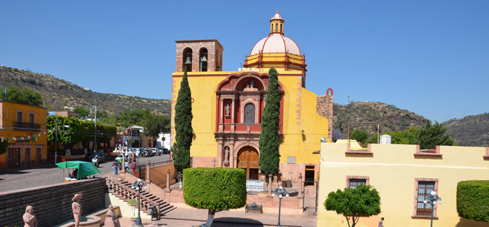
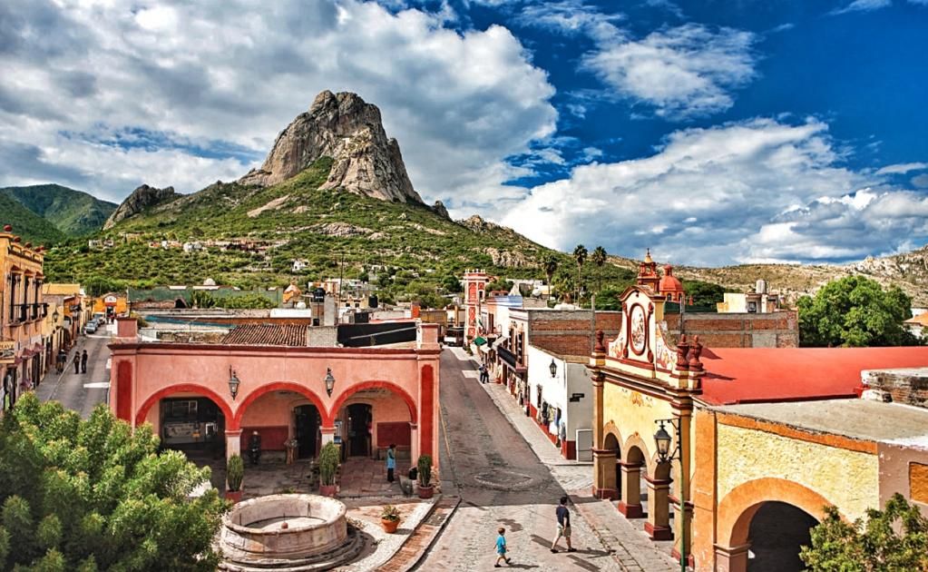
Bernal
Bernal is a small village in the center of the State of Queretaro. It belongs to the Municipality of Ezequiel Montes. Bordering to the East is the State of Hidalgo, to the North, Cadereyta, to the South, Tequisquiapan, and to the West are the municipalities of Colon and Toliman. The distance from Queretaro City to Ezequiel Montes is approximately 63 Kms. From Ezequiel Montes to Bernal it is approximately 17 Kms. Bernal is half an hour from the City of Queretaro.
Pedro Escobedo
Pedro Escobedo named for native son Doctor Pedro Escobedo, is located 21 Miles, from the city of Queretaro and is 6299 ft above sea level. Its climate is sub humid with summer rains and an average temperature of 64° F.
Pedro Escobedo is rich in architectural treasures, among them several beautiful haciendas like the Hacienda Epigmenio Gonzalez, Hacienda Cirilo, Hacienda Escolasticas and Hacienda El Sauz. Hacienda Ajuchitlancito is noteworthy for a lovely granary reinforced by seven buttresses.
Peñamiller
Peñamiller is found along Highway 120, San Juan del Rio – Xilitla in the Sierra Gorda Sierra Gorda, Queretaro, Mexico – Tour By Mexico ® in the northeast part of the Queretaro state, 78 Miles from the city of Queretaro. The climates is dry with occasional rain, and is 4,462 ft above sea level.
The village of Santa Maria de Peñamiller consisted of 37 families when it was founded on the 14th of December, 1748. It was part of the Toliman district until 1941, when it was named a city by then governor Noradino Rubio.
Pinal de Amoles
Pinal de Amoles is made up of words from two languages. The Spanish word Pinal means a forested place, and in Nahuatl, amolli is a sweet potato that is abundant in the area.
At 2,400 meters above sea level, three different types of climates can be found in Pinal de Amoles: humid at the city’s governmental seat, semi-hot and dry in the south and semi-hot and humid in the north. The average annual temperature is 58°F.
To reach Pinal de Amoles from Mexico City, take Highway 57 (Mexico – Queretaro). Then at 171 km, at the turnoff towards San Juan del Rio, take Federal Highway 120 (San Juan del Rio-Xilitla). From San Juan del Rio it is 141 km to the municipal center.
Before the arrival of the Spanish, Pinal de Amoles was populated by the Chichimecas, and its surrounding terrority made up the before of the Mexican empire. In 1931, it became a city, no longer belonging to the District of Jalpan.
Conclusion
With agricultural and livestock farming industries, the state of Queretaro has a largely growing rate of industrial development, and a gateway to the northern, central and southern regions of Mexico.
Its fast industrial development contrasts with the great beauty of its capital city, the historic downtown areas of which were declared Heritage of Mankind by the UNESCO. Its excellent geographic location helped Queretaro to be the scene of most important chapters of Mexican history and you have to get to know this incredible place in Mexico. So what are you waiting for?